Interview with Sawaid Abbas, Assistant Professor at the Centre for Geographical Information, University of the Punjab, Lahore, Pakistan

Sawaid Abbas, Assistant Professor at the Centre for Geographical Information System, University of the Punjab, Lahore, Pakistan discussed his extensive work in addressing water-related challenges through the nexus between smart sensing and space technologies. His thematic focus spans water scarcity, food security, climate risks, and environmental monitoring with an emphasis on the Asia-Pacific region, including Pakistan and China. Key Sustainable Development Goals (SDGs) guiding his work include SDG2 (Zero Hunger), SDG13 (Climate Action), SDG15 (Life on Land), and SDG11 (Sustainable Cities and Communities).
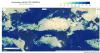
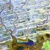
Abbas's passion for water emerged during his early career at the World Wide Fund for Nature (WWF), where he was involved in Pakistan’s Wetland Program and witnessed the impact of water on associated ecosystems. This sparked his interest in understanding and managing water, forestry, and wildlife resources. He recently studied coastal ecosystems and their responses to climate and anthropogenic stressors in the Asia-Pacific region. The Living Indus – Investing in Ecological Restoration has become a new focus of interest for him, addressing sustainability challenges related to food security, river basin management, and efficient water use in alignment with the UN Decade of Ocean objectives.
Abbas shared his fascination with water, recognizing its complex and essential nature. He is captivated by its beauty in all forms and acknowledges its fundamental importance for life on Earth. This water connection further motivates his commitment to addressing global water challenges and promoting sustainable water use through innovative solutions.
Sawaid Abbas's work, stimulated by both professional commitment and personal fascination, stresses the critical role of space technologies, particularly earth observation, smart sensing nexus, and artificial intelligence in addressing water-related challenges. His research contributes to the development of innovative solutions for sustainable water use, environmental protection, and disaster response, aligning with global goals for a more resilient and water-secure future.