Interview with Kabari Sam, Senior Lecturer at University of Portsmouth UK
Dr. Kabari Sam is a Senior Lecturer in Environmental Systems and Course Lead for BSc Environmental Science and BSc Marine Environmental Science at the University of Portsmouth. A Chartered Environmentalist (CEnv), Fellow of the Higher Education Academy (FHEA), and Member of the Institution of Environmental Sciences (MIEnvSc), his research focuses on water quality, hydrocarbon pollution, environmental risk, sustainability, and environmental governance.
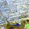
Originally from the Niger Delta region of Nigeria, Dr. Sam’s work is shaped by firsthand experience of the environmental and socio-economic impacts of long-term oil pollution. His research explores contaminated land and groundwater systems, environmental remediation, climate resilience, blue carbon ecosystems, and the public health implications of polluted environments, particularly in vulnerable coastal and oil-impacted communities.
Dr. Sam has contributed to research and advocacy on sustainable water management, mangrove conservation, microplastics pollution, and ecosystem restoration across developing and developed regions. His work increasingly examines how geospatial analysis, Earth Observation technologies, and environmental monitoring can strengthen water governance, improve pollution detection, and support evidence-based decision-making.
Through research, policy engagement, and community advocacy, he has supported initiatives aimed at improving access to safe drinking water and promoting environmental accountability in regions affected by industrial contamination. Passionate about bridging science, policy, and communities, Dr. Sam is committed to advancing sustainable and inclusive approaches to environmental management, climate resilience, and water security.