

The environmental impacts of irrigated agriculture, which demands between 3,000 to 5,000 litres of water to produce just one kilogram of rice, are profound. Considering that 35 per cent of Pakistan’s freshwater is used for rice cultivation, often for crops destined for export, the need for a strategic realignment of water use priorities is evident. Current practices often treat water as an unlimited resource, a perspective that is unsustainable in the face of increasing domestic and international demands for food.
The urgent need for systemic change is clear: only through the adoption of innovative technologies and the integration of up-to-date environmental data can Pakistan hope to meet the Zero Hunger (SDG 2) goal and achieve sustainable development. This project proposes using advanced remote sensing and land use modelling to effectively quantify agricultural land use practices and their changes over time. This integrated assessment framework is vital for building resilience against future climate extremes and for ensuring sustainable agricultural practices that align with societal and environmental priorities. By bridging the gap between current practices and agro-ecological suitability, this project aims to achieve a sustainable, food-secure future for Pakistan.
We aim to interact with multiple stakeholders and agencies with diverse expertise to support data-driven approaches for sustainable water and crop management. Our goal is to build a network of professionals and researchers, facilitate knowledge and technology sharing, and contribute geospatial and analytical solutions to address the challenge.
Has this problem been acknowledged in the past?
Recognizing these challenges, the Pakistan Agriculture Research Council (PARC) updated the agro-ecological zones in 2023 to better align with contemporary environmental conditions and agricultural needs. This revision is crucial for identifying optimal areas for crop cultivation and livestock production, aiming to facilitate climate-smart agricultural practices that are robust against future climate extremes. However, persistent gaps between existing cropping practices and the newly defined zones highlight a critical disconnect that could undermine the socio-economic and environmental sustainability of Pakistan's agricultural sector.
Can this challenge be solved using space technologies and data?
This proposed challenge aims to merge cutting-edge technologies such as remote sensing, machine learning, data analytics, and econometric modeling to critically evaluate current agricultural land use practices and their future sustainability, thereby supporting the agricultural land use policy process in Pakistan. The work is structured around three major scientific components:
- A package focused on the evaluation of land use practices and change analysis from 1980s to 2025 using satellite remote sensing and machine learning algorithms;
- A spatially explicit econometric land use model that incorporates household survey data, government policies, and related statistical data to analyze the drivers of land use change and explore the potential socioeconomic effects;
- An environmental evaluation model that is integrated with the land use model to assess the impacts of land use changes on ecosystem services and land degradation.
Through ongoing collaboration with relevant national agencies, the findings from these components will be synthesized to effectively accelerate the agricultural land use policy process in Pakistan.
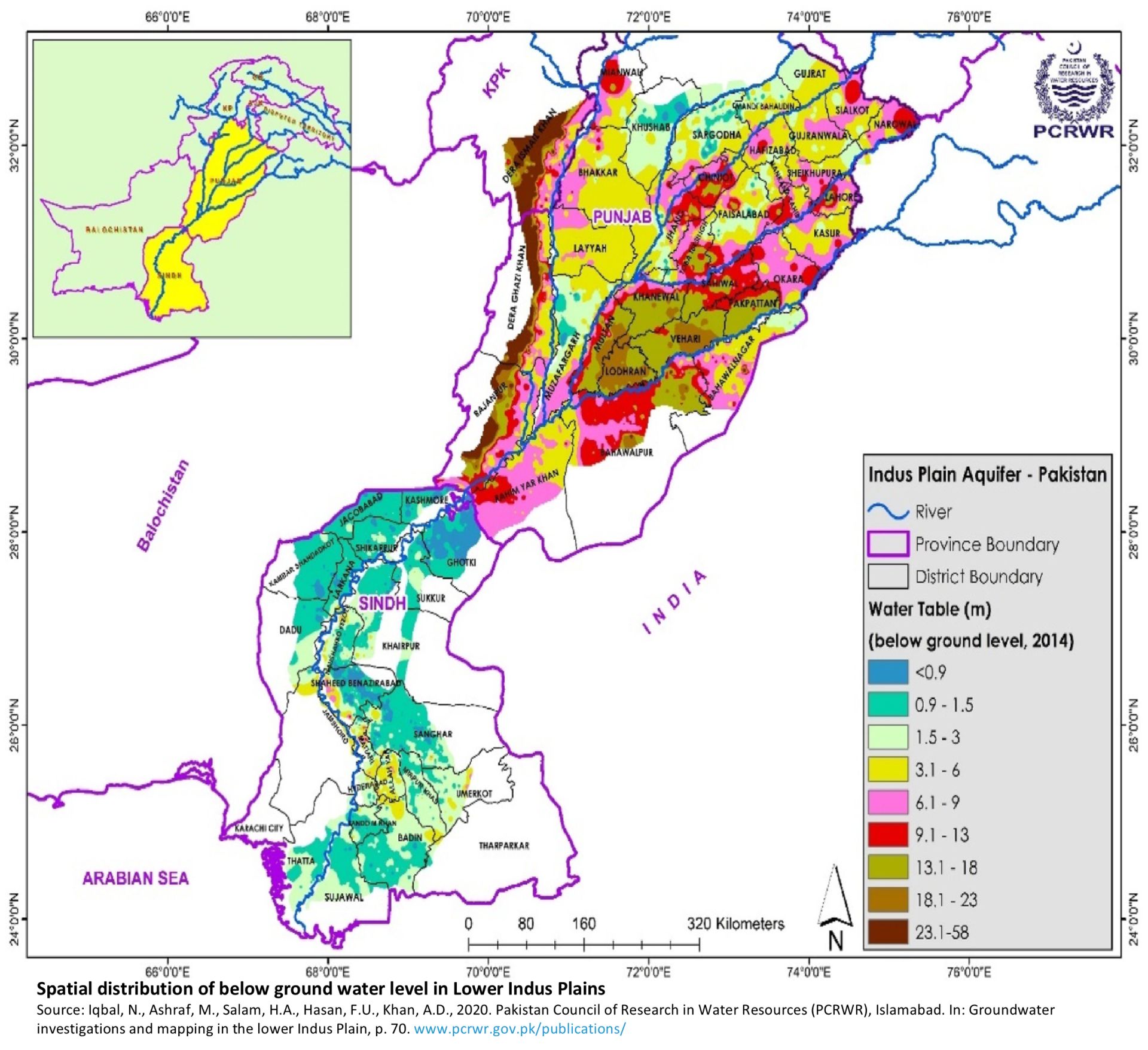
We have access to the required datasets, primarily through the institutions involved in the assessment. These include field data for crops, water use statistics, water availability, and crop type distribution, among others.
For more detailed analysis and crop identification, we will require high spatial and temporal resolution imagery. Satellite data with <1m resolution and high revisit frequency would be ideal. Access to high-resolution hyperspectral imagery, soil moisture maps, and evapotranspiration products will also be important.
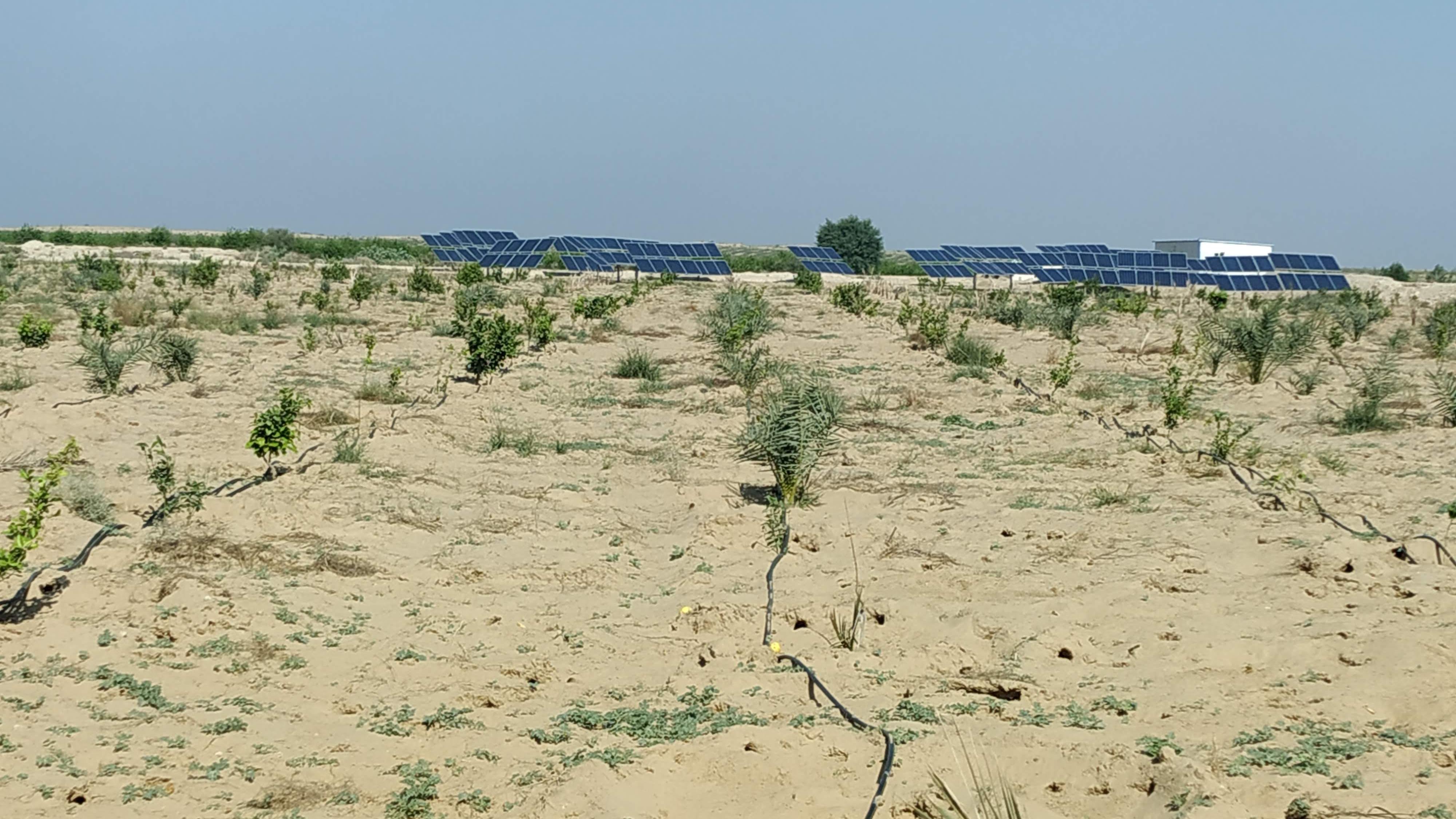
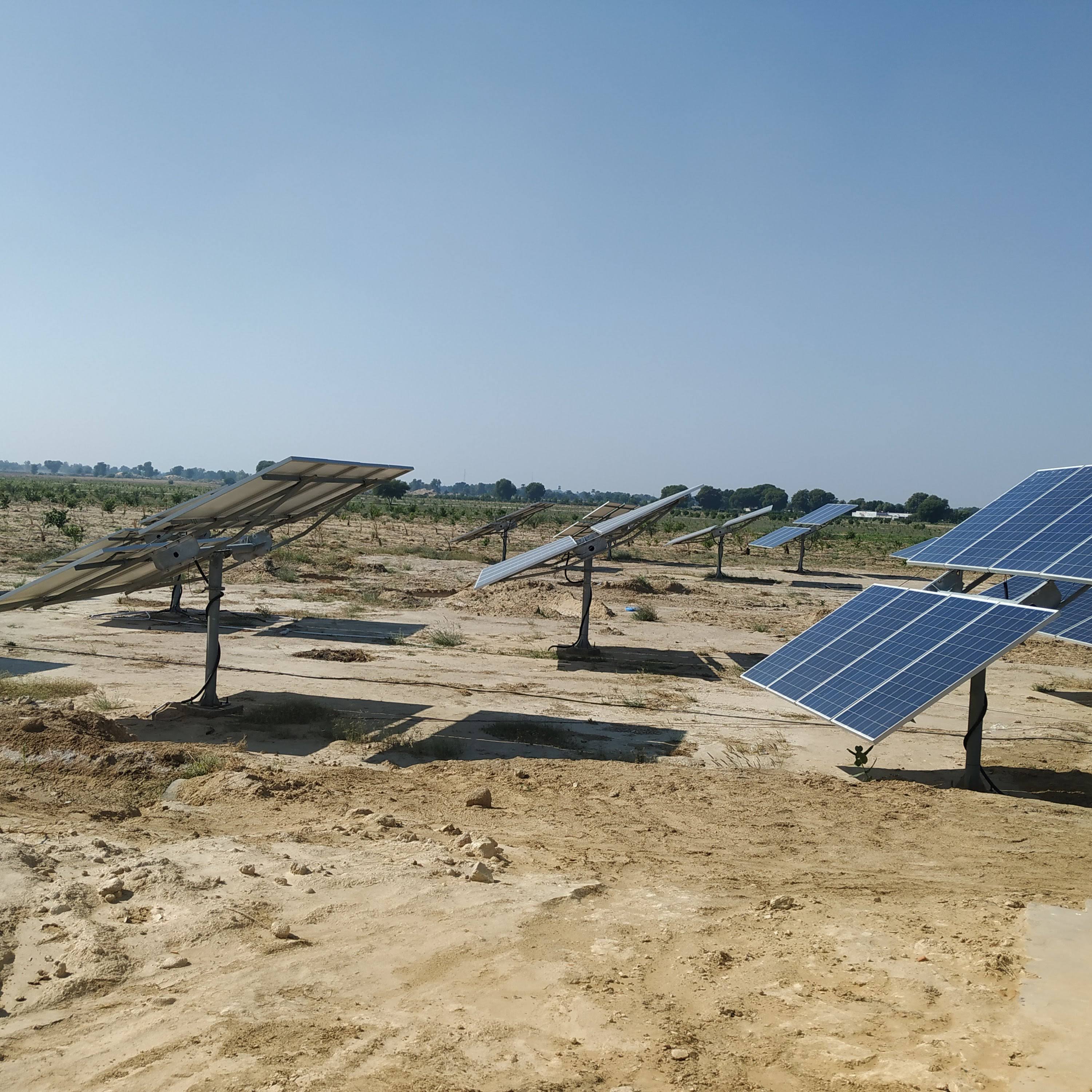
We see strong value in leveraging space-based technologies—especially using deep learning algorithms on high-frequency satellite data for crop mapping and water monitoring. Additional use cases may include the identification of solar panels in agricultural fields and other emerging challenges relevant to water-energy-food systems.
Expected timeframe to develop a solution
2-3 years
Potential consequences if no action happens
If no action is taken, the growing water crisis and intensifying climate change will severely threaten food security, with projections indicating that up to 50 per cent of global food production could be compromised by 2050. In Pakistan, unsustainable water use—such as the excessive extraction for water-intensive crops like rice, which consumes 3,000 to 5,000 litres per kilogram—will strain freshwater resources, jeopardizing both domestic food supply and agricultural exports. Coupled with environmental degradation and a rapidly growing population, the disconnect between current farming practices and sustainable water management poses a critical risk to long-term food and water security.
What are additional physical requirements for a solution?
- Advanced Data Infrastructure: High-performance computing facilities and cloud-based platforms to process and analyse large datasets, including high-resolution satellite imagery for crop and water resource mapping.
- Laboratories and Research Facilities: Well-equipped labs for soil and water testing, crop analysis, and the development of sustainable farming practices tailored to local conditions.
- Capacity Building Infrastructure: Training centres and demonstration farms to educate farmers and stakeholders on sustainable practices, water-efficient technologies, and data-driven decision-making.
- Policy and Institutional Frameworks: Strong institutional support with physical offices and resources to coordinate research, implementation, and monitoring of sustainable agricultural and water management strategies.
We have support from partners such as ICIMOD, PARC, and the Punjab Irrigation Department, who will contribute in terms of data, domain expertise, and institutional coordination.
To address these multifaceted challenges, there is a pressing need for a robust data-driven economic and sustainability assessment framework.


