Groundwater is the largest accessible source of freshwater on Earth and a vital lifeline for billions of people, particularly in arid and semi-arid regions. However, unsustainable extraction, weak governance and climate change are causing severe depletion of aquifers worldwide. Mismanagement leads to long-term water scarcity, declining groundwater quality and in many regions, permanent land subsidence (Famiglietti 2014).
Monitoring groundwater is challenging because aquifers are largely invisible. Space-based technologies such as GRACE and GRACE-FO provide tools to measure groundwater mass change at large scales, while radar interferometry (InSAR) detects land subsidence caused by overextraction. When combined with ground-based measurements, these space observations enable governments and communities to manage groundwater more sustainably (Rezaie Boroon and Fisher 2012; Gautam, Chandra, and Henry 2024).
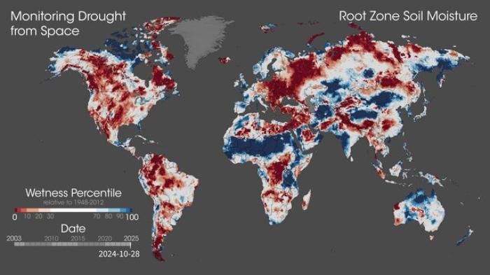
When direct groundwater measurements are unavailable, surface indicators such as soil moisture, vegetation health, and evapotranspiration can reveal groundwater use. This is especially true in arid, permeable, or irrigated regions where shallow groundwater strongly influences crops and soil conditions. While remote sensing does not measure extraction directly, high-resolution imagery (e.g., Landsat evapotranspiration data) can help infer groundwater dependence where surface water is limited. (Adams et al. 2022)
Space technologies to support managing water scarcity, drought and groundwater
Space technologies are the key to addressing the water-related challenges in relation to water scarcity, drought and groundwater. Uniquely, GRACE and GRACE-FO can observe mass changes in water storage (UNOOSA, 2023). In general, space technologies in combination with GIS can be used for detecting water stress in crops, assessing soil moisture, performing drought severity assessments and analysing land use changes.
| Components | Variables | Space-based technology | Example missions |
| Groundwater | Reservoir storage change | Gravity anomalies | GRACE/ GRACE-FO |
| Land subsidence (overextraction) | Radar interferometry (InSAR) | Sentinel-1, (NISAR) | |
| Precipitation | Rainfall intensity | Active and passive microwave sensors | GPM AQUA TROPCIS TMPA CHIRPS (IR, VIS, NIR) AMSR2 (GCOMW1) SSMIS (DMSP) MetOpB/C |