Water scarcity

"Occurs when the freshwater demands linked to specific social, economic and environmental needs of a community exceed the available water supply." (United Nations Publications, 2013)

Sources

United Nations Publications. "Glossary of Shared Water Resources (English-Arabic): Technical, Socioeconomic and Legal Terminology." (2013). DOI:https://dx.doi.org/10.18356/70b462ce-en

Related Content

Article

Interview with Dr. Sherine Ahmed El Baradei

The following interview with Dr. Sherine Ahmed El Baradei is focusing on water quality and its relation to space technology. Water is the essence of life. Thus preservation of water quality is of a big concern to human health and to fauna and flora in water bodies. The interview explains what is water quality and what are water quality parameters of water bodies. Furthermore, the importance of using space technologies and applications in contributing to water quality monitoring and determination of hydraulic and hydrologic conditions is thoroughly discussed. For example, temporal resolution of satellites and their role in obtaining accurate imaging and data is clarified and the satellites concerned with water quality monitoring are pointed out. Considering the important role of groundwater in arid regions, the use of GRACE Mission data in Egypt is mentioned. Moreover, key influences on water quality in Egypt are discussed and the relation of water quality to water scarcity in the country and ways to preserve water quality is being discussed. Furthermore, the potential of space-based monitoring used to address water issues from hydrological to water resources issues in the country or region is pointed out. The challenges of the use of space technology for hydrology and water-related topics in the MENA region is also discussed. Light is shed on the project done by NASA to recycle astronauts’ waste into energy and power. Sustainability is of a great importance to or communities, and thus it is discussed how sustainable it is to build cities in the desert, or to divert water to where people are instead of moving people to existing water sources. Finally, a discussion about ways we can employ to improve awareness and capacity building on the use of space technology for water and challenges in this field are discussed.

Interview with Sawaid Abbas, Assistant Professor at the Centre for Geographical Information, University of the Punjab, Lahore, Pakistan

Sawaid Abbas, Assistant Professor at the Centre for Geographical Information System, University of the Punjab, Lahore, Pakistan discussed his extensive work in addressing water-related challenges through the nexus between smart sensing and space technologies. His thematic focus spans water scarcity, food security, climate risks, and environmental monitoring with an emphasis on the Asia-Pacific region, including Pakistan and China. Key Sustainable Development Goals (SDGs) guiding his work include SDG2 (Zero Hunger), SDG13 (Climate Action), SDG15 (Life on Land), and SDG11 (Sustainable Cities and Communities).  Abbas's passion for water emerged during his early career at the World Wide Fund for Nature (WWF), where he was involved in Pakistan’s Wetland Program and witnessed the impact of water on associated ecosystems. This sparked his interest in understanding and managing water, forestry, and wildlife resources. He recently studied coastal ecosystems and their responses to climate and anthropogenic stressors in the Asia-Pacific region. The Living Indus – Investing in Ecological Restoration has become a new focus of interest for him, addressing sustainability challenges related to food security, river basin management, and efficient water use in alignment with the UN Decade of Ocean objectives.  Abbas shared his fascination with water, recognizing its complex and essential nature. He is captivated by its beauty in all forms and acknowledges its fundamental importance for life on Earth. This water connection further motivates his commitment to addressing global water challenges and promoting sustainable water use through innovative solutions.  Sawaid Abbas's work, stimulated by both professional commitment and personal fascination, stresses the critical role of space technologies, particularly earth observation, smart sensing nexus, and artificial intelligence in addressing water-related challenges. His research contributes to the development of innovative solutions for sustainable water use, environmental protection, and disaster response, aligning with global goals for a more resilient and water-secure future. 

Hydro-diplomacy: The role of space-derived data in advancing water security

Water scarcity is one of the greatest threats faced by humanity of our time – in 2019, more than two billion people experience high water stress (UN-Water 2019) and approximately four billion people suffer from severe water scarcity for at least one month per year (Mekonnen and Hoekstra 2016). This worsening problem increases the risk of international conflict over water resources breaking out, given that there are over 270 transboundary river basins, and three-quarters of UN Member States share at least one river or lake basin with a neighbour (UN News 2017).

United Nations/Ghana/PSIPW - 5th International conference on the use of space technology for water resources management

From 10 to 13 May 2022, the United Nations Officer for Outer Space Affairs organized the 5th International conference on the use of space technology for water resources management. The conference was hosted in a hybrid format in Accra, Ghana, by the University of Energy and Natural Resources, Sunyani on behalf of the Government of Ghana. The event was attended by several senior government representatives of the host country including Dr. Mahamudu Bawumia, Vice President of the Republic of Ghana, the Honorary Minister of Education Dr.

Pénuries d'Eau en Milieu Urbain : Comment les Données de la Mission GRACE-FO de la NASA Peuvent-Elles Soutenir la Gestion de l'Eau en Temps Quasi-Réel ?

Plus la population augmente, plus la demande en eau augmente, notamment l'eau nécessaire aux usages domestiques, industriels et municipaux (Mogelgaard 2011). L'Inde en est un bon exemple : le 20 juin 2019, la ville de Chennai a failli manquer d'eau. Des images satellites ont montré l'ampleur de la pénurie d'eau dans la ville (schéma 1). Alors que les habitants faisaient la queue pour de l'eau stockée dans des camions-citernes qui la rendaient disponible dans la ville, le véritable défi de gestion concernait les bâtiments municipaux et les entreprises de la ville. La pénurie d´eau a gravement affecté la capacité des hôpitaux à soigner les patients et à nettoyer les équipements, et a contraint les entreprises à fermer leurs portes jusqu'à la fin de la crise.

Urban Water Scarcity: How data from NASA’s GRACE-FO Mission can be used for (near) real time water management

As population becomes larger the demand for water soars, including water needed for domestic, industrial and municipal uses (Mogelgaard 2011). One example of that, is India, where on 20 June 2019 the city of Chennai almost run out of water. Satellite images show the extent of the water shortage in the city (figure 1). While people are queuing up to get water from water trucks that transfer water to the city, the greatest struggle is taking place in the city’s municipal buildings and businesses. Hospitals are facing the threat of not having enough water to treat patients and to clean equipment, and businesses are forced to shut down and wait until the crisis is over.

Escasez urbana de agua: cómo pueden utilizarse los datos de la misión GRACE-FO de la NASA para la gestión del agua (casi) en tiempo real

As population becomes larger the demand for water soars, including water needed for domestic, industrial and municipal uses (Mogelgaard 2011). One example of that, is India, where on 20 June 2019 the city of Chennai almost run out of water. Satellite images show the extent of the water shortage in the city (figure 1). While people are queuing up to get water from water trucks that transfer water to the city, the greatest struggle is taking place in the city’s municipal buildings and businesses. Hospitals are facing the threat of not having enough water to treat patients and to clean equipment, and businesses are forced to shut down and wait until the crisis is over.

Interview with Alicia Simón Sisimit, Kaqchikel Journalist and activist at DDASO Project

Short description of the Kaqchikel community

The municipality of San José Poaquil was founded on November 1, 1891. It is located in the department of Chimaltenango with a territorial extension of approximately 100 km² and has almost 30 000 inhabitants. It is one of the 16 municipalities that make up the department of Chimaltenango. It is located in the west of the Republic of Guatemala at a distance of 101 kilometers from the Capital City and distance 47 kilometers from the Departmental Capital.

Interview with Dr. Sherine Ahmed El Baradei

The following interview with Dr. Sherine Ahmed El Baradei is focusing on water quality and its relation to space technology. Water is the essence of life. Thus preservation of water quality is of a big concern to human health and to fauna and flora in water bodies. The interview explains what is water quality and what are water quality parameters of water bodies. Furthermore, the importance of using space technologies and applications in contributing to water quality monitoring and determination of hydraulic and hydrologic conditions is thoroughly discussed. For example, temporal resolution of satellites and their role in obtaining accurate imaging and data is clarified and the satellites concerned with water quality monitoring are pointed out. Considering the important role of groundwater in arid regions, the use of GRACE Mission data in Egypt is mentioned. Moreover, key influences on water quality in Egypt are discussed and the relation of water quality to water scarcity in the country and ways to preserve water quality is being discussed. Furthermore, the potential of space-based monitoring used to address water issues from hydrological to water resources issues in the country or region is pointed out. The challenges of the use of space technology for hydrology and water-related topics in the MENA region is also discussed. Light is shed on the project done by NASA to recycle astronauts’ waste into energy and power. Sustainability is of a great importance to or communities, and thus it is discussed how sustainable it is to build cities in the desert, or to divert water to where people are instead of moving people to existing water sources. Finally, a discussion about ways we can employ to improve awareness and capacity building on the use of space technology for water and challenges in this field are discussed.

Interview with Nokubonga Mazibuko, Commissioner at the Commission on Khoi-San Matters, South Africa

Disclaimer!

I should note that this interview does not aim to compare the San women of Platfontein with the Zulu women from Folweni as these are totally different communities. Also, as much as I am a Commissioner, this interview is not done on behalf of the Commission on Khoi-San Matters (CKSM) but on my personal capacity as a researcher and academic who has an interest on issues pertaining to women.

Interview with Sawaid Abbas, Assistant Professor at the Centre for Geographical Information, University of the Punjab, Lahore, Pakistan

Sawaid Abbas, Assistant Professor at the Centre for Geographical Information System, University of the Punjab, Lahore, Pakistan discussed his extensive work in addressing water-related challenges through the nexus between smart sensing and space technologies. His thematic focus spans water scarcity, food security, climate risks, and environmental monitoring with an emphasis on the Asia-Pacific region, including Pakistan and China. Key Sustainable Development Goals (SDGs) guiding his work include SDG2 (Zero Hunger), SDG13 (Climate Action), SDG15 (Life on Land), and SDG11 (Sustainable Cities and Communities).  Abbas's passion for water emerged during his early career at the World Wide Fund for Nature (WWF), where he was involved in Pakistan’s Wetland Program and witnessed the impact of water on associated ecosystems. This sparked his interest in understanding and managing water, forestry, and wildlife resources. He recently studied coastal ecosystems and their responses to climate and anthropogenic stressors in the Asia-Pacific region. The Living Indus – Investing in Ecological Restoration has become a new focus of interest for him, addressing sustainability challenges related to food security, river basin management, and efficient water use in alignment with the UN Decade of Ocean objectives.  Abbas shared his fascination with water, recognizing its complex and essential nature. He is captivated by its beauty in all forms and acknowledges its fundamental importance for life on Earth. This water connection further motivates his commitment to addressing global water challenges and promoting sustainable water use through innovative solutions.  Sawaid Abbas's work, stimulated by both professional commitment and personal fascination, stresses the critical role of space technologies, particularly earth observation, smart sensing nexus, and artificial intelligence in addressing water-related challenges. His research contributes to the development of innovative solutions for sustainable water use, environmental protection, and disaster response, aligning with global goals for a more resilient and water-secure future. 

Interview with Lilian Nguracha Balanga, Founder of Women.conserve

Short description of the Samburu community

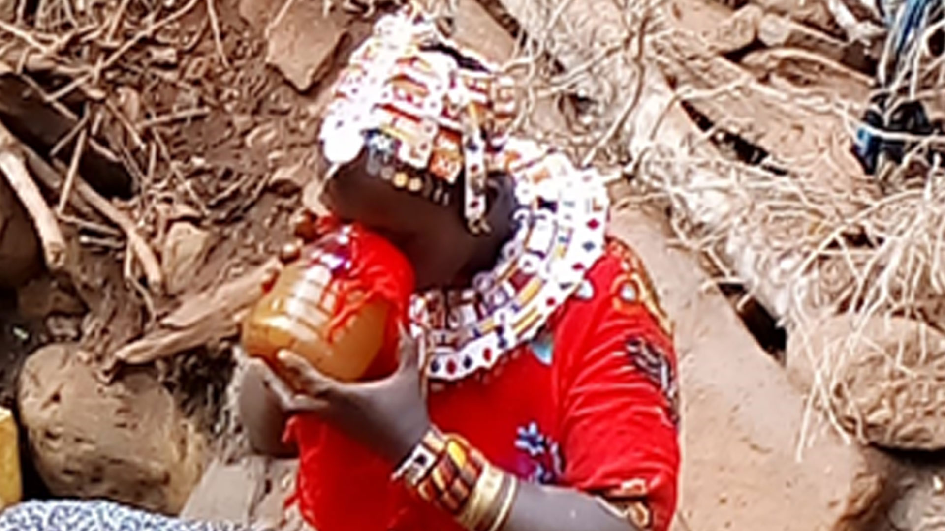
The Samburu community is the Nilotic ethnic community of North Central Kenya. They dress in red shukas and adorn themselves with necklaces, bracelets and anklets mostly from beads. They believe in God Nkai, living in the mountains. They are nomadic are pastoralists, meaning that they keep animals (e.g., cows, goats, sheep and camel) which is their main source of livelihood as they get milk, meat and blood for self consumption and/or to be sold. They move from place to place in search of pasture and water.

European Space Agency’s “Water Scarcity” Kick-Start

The challenge

Water is one of the most important substances on Earth and covers 70% of the planet. However, freshwater makes up a very small fraction with 97% being saline and ocean-based. While the amount of freshwater on the planet has remained fairly constant over time, the world’s population has exploded, meaning that freshwater is threatened by significant forces, like overdevelopment, polluted runoff, and global warming. 

Interview with Alicia Simón Sisimit, Kaqchikel Journalist and activist at DDASO Project

Short description of the Kaqchikel community

The municipality of San José Poaquil was founded on November 1, 1891. It is located in the department of Chimaltenango with a territorial extension of approximately 100 km² and has almost 30 000 inhabitants. It is one of the 16 municipalities that make up the department of Chimaltenango. It is located in the west of the Republic of Guatemala at a distance of 101 kilometers from the Capital City and distance 47 kilometers from the Departmental Capital.

Interview with Nokubonga Mazibuko, Commissioner at the Commission on Khoi-San Matters, South Africa

Disclaimer!

I should note that this interview does not aim to compare the San women of Platfontein with the Zulu women from Folweni as these are totally different communities. Also, as much as I am a Commissioner, this interview is not done on behalf of the Commission on Khoi-San Matters (CKSM) but on my personal capacity as a researcher and academic who has an interest on issues pertaining to women.

Interview with Lilian Nguracha Balanga, Founder of Women.conserve

Short description of the Samburu community

The Samburu community is the Nilotic ethnic community of North Central Kenya. They dress in red shukas and adorn themselves with necklaces, bracelets and anklets mostly from beads. They believe in God Nkai, living in the mountains. They are nomadic are pastoralists, meaning that they keep animals (e.g., cows, goats, sheep and camel) which is their main source of livelihood as they get milk, meat and blood for self consumption and/or to be sold. They move from place to place in search of pasture and water.

Event

Local Perspectives Case Studies

Integrated water resource management for sustainable agriculture: data-driven approaches to optimize crop patterns and water use in Pakistan

Image of dry landscape and solar panels in the distance
The environmental impacts of irrigated agriculture, which demands between 3,000 to 5,000 litres of water to produce just one kilogram of rice, are profound. Considering that 35 per cent of Pakistan’s freshwater is used for rice cultivation, often for crops destined for export, the need for a strategic realignment of water use priorities is evident. Current practices often treat water as an unlimited resource, a perspective that is unsustainable in the face of increasing domestic and international demands for food. The urgent need for systemic change is clear: only through the adoption of innovative technologies and the integration of up-to-date environmental data can Pakistan hope to meet the Zero Hunger (SDG 2) goal and achieve sustainable development. This project proposes using advanced remote sensing and land use modelling to effectively quantify agricultural land use practices and their changes over time. This integrated assessment framework is vital for building resilience against future climate extremes and for ensuring sustainable agricultural practices that align with societal and environmental priorities. By bridging the gap between current practices and agro-ecological suitability, this project aims to achieve a sustainable, food-secure future for Pakistan. We aim to interact with multiple stakeholders and agencies with diverse expertise to support data-driven approaches for sustainable water and crop management. Our goal is to build a network of professionals and researchers, facilitate knowledge and technology sharing, and contribute geospatial and analytical solutions to address the challenge.

Stakeholder

Remote Sensing, GIS and Climatic Research Lab, University of the Punjab

The emerging demand of GIS and Space Applications for Climate Change studies for the socio-economic development of Pakistan along with Government of Pakistan Vision 2025, Space Vision 2047 of National Space Agency of Pakistan, and achievement of UN Sustainable Development Goals (SDGs) impelled the Higher Education Commission of Pakistan (HEC) to establish Remote Sensing, GIS and Climatic Research Lab (RSGCRL) at University of the Punjab, Lahore, Pakistan.

Person

Space-based Solution

Addressed challenge(s)

The disappearance of Lake Ol’ Bolossat: a threat to biodiversity, livelihoods and water security in central Kenya

Collaborating actors (stakeholders, professionals, young professionals or Indigenous voices)
Suggested solution

To establish an integrated monitoring and decision-support system that uses Earth Observation data and machine learning to track the status of Lake Ol' Bolossat, enabling evidence-based conservation and sustainable development actions.

Requirements

Data

Below is a table showing the data requirements and sources.

Data sourceUse casePeriod
JRC GSWHistorical water extents1984 - 2023
Sentinel-1 SARWater extent during cloud-cover seasons2014 - present
Sentinel-2 2 MSIHabitat classification, NDVI, MNDWI, NDBI2015 - present
MODISNDVI/ET anomalies and drought indicators2000 - present
Rainfall and climate (CHIRPS/ERA5)Climate trend correlation with hydrological changes1984 - present
Population/Human settlement (WorldPop, GHSL)Land use pressure mapping2000 - present
Field surveys and local NGO dataValidation and community-level observationsAs available

Software

The analysis is being done using open-source platforms and software: Google Earth Engine and QGIS.

To access Google Earth Engine, one needs a Google account that will be linked to the platform link. If you are new to the platform, create an account, and you can start using it. If you already have an account, just sign in and be directed to the code editor. If you are new to the software, you can access the training manual here.

To access QGIS, you need to download it as it is a software, link. If you are new to the software, you can access the training manual here.

Physical

  1. Establishment of Ground Monitoring Stations
  • Purpose: To validate satellite data and collect real-time, on-the-ground water level, rainfall, and biodiversity observations.
  • Components: Water gauges, weather sensors, camera traps for biodiversity, and simple soil moisture probes.


  1. Community Information Boards or Digital Kiosks
  • Purpose: To display maps, water level trends, and habitat updates to residents in a simplified, accessible format.
  • Location: Strategic points around the lake (e.g., near schools, water collection points, community centers).


  1. Buffer Zone Demarcation and Fencing
  • Purpose: To physically protect critical wetland habitats and prevent encroachment or grazing in sensitive areas.
  • Details: Fencing or natural barriers like vegetation planting along designated riparian zones.


  1. Construction of a Local Conservation and Data Hub
  • Purpose: To provide a space for community meetings, training sessions, citizen science coordination, and storing field equipment.
  • Location: Ideally within a local government or NGO compound near the lake.


  1. Rehabilitation of Degraded Wetlands
  • Purpose: Restore areas where the lakebed or surrounding wetlands have been severely altered.
  • Methods: Planting of indigenous wetland vegetation, removal of invasive species, and controlled re-wetting.


  1. Water Resource Management Infrastructure
  • Purpose: To improve the regulation and sustainable use of the lake's water.
  • Examples: Controlled inflow/outflow channels, community-led irrigation management systems, water pans for livestock to reduce direct lake access.


  1. Signage and Protected Area Boundary Markers
  • Purpose: To raise awareness of Lake Ol’ Bolossat’s legal protection status and to visually communicate boundaries to land users.
  • Materials: Durable signs, educational posters, and protected area plaques.


  1. Solar-Powered Connectivity Units (Optional but strategic)
  • Purpose: For uplinking field sensor data or enabling access to the online dashboard in remote locations.
  • Components: Solar panels, GSM routers, rugged tablets or data loggers.

Outline steps for a solution

Phase 1: Planning and Stakeholder Engagement – To do

The first phase involves defining the objectives of the monitoring system and identifying measurable success indicators aligned with conservation priorities and local needs. This is followed by engaging key stakeholders such as the National Environment Management Authority (NEMA), Kenya Wildlife Service (KWS), Water Resources Authority (WRA), Nyandarua County Government, and local community-based organizations. Stakeholder consultations are critical for gathering input on data needs, identifying decision-making gaps, and ensuring buy-in from both policy actors and community leaders. A situational analysis should be conducted to map existing infrastructure, technical capacity, internet access, and human resources available on the ground, helping to identify opportunities and constraints for implementation.

Phase 2: Data Collection and System Design – In progress

In this phase, a comprehensive monitoring framework is developed, specifying the key indicators to be tracked, such as seasonal water extent, land cover transitions, and flood-prone zones. Relevant Earth observation datasets are selected, including Sentinel-1 SAR for water extent, Sentinel-2 for habitat classification, JRC Global Surface Water for historical trends, and CHIRPS for rainfall data. A prototype dashboard is developed using Google Earth Engine, visualizing these datasets through maps, time series graphs, and interactive overlays. Simultaneously, field validation activities are conducted to ground-truth satellite-derived maps. This includes collecting GPS points, photos, and observations on vegetation, land use, and visible signs of degradation, ensuring the remote sensing outputs are accurate and contextually relevant.

Phase 3: System Testing and Expansion – To do

Once the prototype is ready, it is tested with stakeholders through pilot sessions and community workshops. These engagements are used to collect feedback on the dashboard’s usability, relevance, and user experience, particularly for non-technical audiences. Revisions are made to improve clarity, layer toggling, labelling, and interpretability. In parallel, basic physical interventions begin, such as the installation of simple water gauges, informational signboards, and boundary markers for conservation zones. These elements help translate digital insights into tangible tools for the community. Plans for expanding field infrastructure, such as creating buffer zones or establishing a local conservation hub, are also explored during this phase.

Phase 4: Deployment and Knowledge Sharing – In progress

Following successful pilot testing and system refinement, the full monitoring platform is deployed on a publicly accessible hosting environment, such as Firebase, Earth Engine Apps, or a custom-built website. The platform is shared with agencies and conservation partners, accompanied by a rollout plan that includes formal training sessions. These capacity-building workshops are designed to empower users, ranging from government officers to youth groups, with the skills to interpret dashboard outputs and use the data in planning and response. User guides, translated materials, and offline summaries are provided to support long-term usability and local ownership.

Phase 5: Monitoring, Maintenance, and Scaling – To do

The final phase focuses on monitoring the performance and real-world impact of the system. Regular evaluations are conducted to assess usage, data accuracy, stakeholder engagement, and improvements in environmental decision-making. Lessons learned are used to refine system features, add new datasets, and introduce functionalities such as alert notifications or mobile-friendly access. The success of the Lake Ol’ Bolossat solution creates a foundation for scaling to other endangered wetlands across Kenya, such as Lakes Baringo, Naivasha, or Kanyaboli. Finally, the project contributes to the broader Space4Water and open science communities by publishing methods, code, and findings on platforms like GitHub and Earth Engine’s asset repository, ensuring transparency, replicability, and collaboration.

Results

The Lake Ol’ Bolossat monitoring system, currently at prototype stage, holds significant potential to transform how freshwater ecosystems are managed at local and national levels. By integrating satellite-derived water and habitat data into an accessible dashboard, the system aims to bridge the gap between Earth observation science and on-the-ground conservation action. Once implemented with key stakeholders and end users, the following impacts are anticipated:

  1. Support for Environmental Agencies and County Governments: The system could enhance the capacity of institutions such as the National Environment Management Authority (NEMA), Kenya Wildlife Service (KWS), Water Resources Authority (WRA), and the Nyandarua County Government by providing timely, location-specific data for decision-making on lake and wetland management.
  2. Early Warning for Hydrological and Ecological Risks: The dashboard could enable stakeholders to detect abnormal patterns in water extent, such as persistent shrinkage or sudden expansion, triggering early intervention to prevent ecological degradation or disaster impacts on nearby communities.
  3. Community Awareness and Engagement: By visualizing seasonal and long-term changes, the system can be used to build awareness among residents, farmers, and water users around Lake Ol’ Bolossat, empowering them to engage in sustainable practices and to advocate for the protection of the lake.
  4. Policy-Relevant Monitoring Tool: The platform can serve as a long-term environmental monitoring tool to support the implementation of wetland protection policies, local water catchment strategies, and integrated land use planning frameworks.
  5. Scalability to Other Freshwater Ecosystems: Once validated, the approach used at Lake Ol’ Bolossat can be adapted to other small inland water bodies across Kenya and East Africa, particularly those facing similar risks of drying, encroachment, or biodiversity loss.
  6. Alignment with Global and National Development Goals: The system supports Kenya’s contributions to Sustainable Development Goals (SDGs), particularly:
  • SDG 6: Ensure availability and sustainable management of water and sanitation
  • SDG 13: Take urgent action to combat climate change and its impacts
  • SDG 15: Protect, restore and promote sustainable use of terrestrial ecosystems and halt biodiversity loss
Related space-based solutions
Keywords (for the solution)
Climate Zone (addressed by the solution)
Habitat (addressed by the solution)
Region/Country (the solution was designed for, if any)
Relevant SDGs