Interview with Prof. Wolfgang Wagner
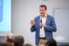
Professor Wagner holds a Ph.D. in remote sensing. He gained his experience at renowned institutions, including academia, space agencies and international organisations. He is the Dean of the Faculty for Mathematics and Geoinformation and cofounder of the Earth Observation Data Centre for Water Resources among other affiliations.