

About this event
Join the UK Space Agency’s award-winning International Partnership Programme (IPP) series of regional webinars across Asia-Pacific, Africa, and Latin America & Caribbean. IPP projects will be showcasing their satellite applications, capabilities and outcomes tackling global development challenges including climate change, agriculture, maritime security, humanitarian, and disaster resilience.
What is the International Partnership Programme (IPP)?
The UK Space Agency’s International Partnership Programme (IPP) is an award-winning >£150 million space for sustainable development initiative which utilises the UK space sector’s capabilities in satellite technology and data services to deliver measurable and sustainable economic, societal and/or environmental benefits in partnership with developing countries. Since 2016, IPP has grant-funded 43 projects in 47 countries across Africa, Asia-Pacific and Latin America to develop space-based solutions which tackle global development challenges such as climate and disaster resilience, food security, maritime issues, disease forecasting, and improving access to financial services, whilst facilitating new trade opportunities for the UK space sector.
IPP is funded from the Department for Business, Energy and Industrial Strategy’s (BEIS) Global Challenges Research Fund (GCRF). This £1.5 billion Official Development Assistance (ODA) fund supports cutting-edge research and innovation on global issues affecting developing countries. ODA-funded activity focuses on outcomes that promote long-term sustainable development and growth in countries on the OECD Development Assistance Committee (DAC) list. IPP is ODA compliant, being delivered in alignment with UK Aid Strategy and the United Nations’ (UN) Sustainable Development Goals (SDGs).
Who are these webinars for?
- Existing and new international partners, e.g. inter-governmental organisations, industry, academia, NGO's, development agencies, etc.
- Investors
- Science and innovation networks
- Donors, foundations
- UK and international government representatives working in Embassies/High Commissions
- UK cross-government stakeholders
IPP projects presenting in this webinar:
RE-SAT (Renewable Energy Space Analytics Tool) (Institute of Environmental Analytics) (Climate/Renewable Energy)
The RE-SAT project has developed a cutting-edge energy analytics platform to support the planning of renewable energy infrastructure from national transition strategies down to individual project assessment.
gEOthermalKenya (Omanos Analytics) (Climate/Renewable Energy)
gEOthermalKenya aims to characterise and monitor land-use around current and prospective geothermal power plants. The goal of the project is to support the socially, environmentally, and economically sustainable growth of the Kenyan geothermal sector.
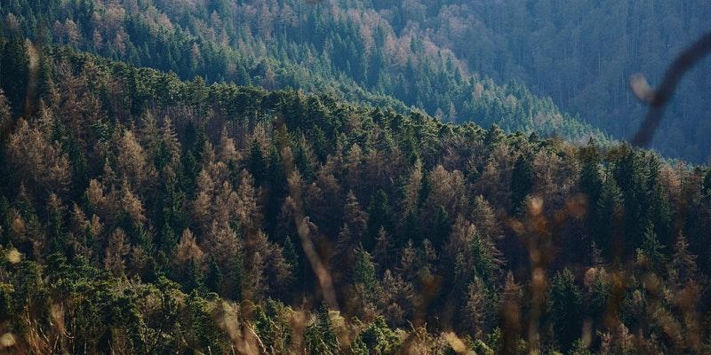
Forests 2020 (Ecometrica) (Climate/Forestry)
Forests 2020 aims to protect and restore of up to 300 million hectares of tropical forests by improving national forest monitoring systems in seven partner countries through better applications of satellite data.
EO4SAS (Earth Observation for Sustainable Aggregate Supply) (Pixalytics) (Climate)
Earth Observation for Sustainable Aggregate Supply (EO4SAS) that aims to provide Kenya with Earth observation data and ideas on how the country might improve the management of its sand resources.
OASIS-TU/MSIS-TU (exactEarth Europe Ltd) (Maritime)
These projects are small vessel safety and tracking initiatives using exactTrax – a tracking and safety of life service for small vessels using simple to deploy satellite transponders.
EASOS (Earth and Sea Observation System) - Marine Watch and Flood Watch (Satellite Applications Catapult) (Climate/Maritime/Forestry)
The Earth and Sea Observation System (EASOS) developed three innovative tools – Flood Watch, Marine Watch and Forest Watch – which use satellite data to detect, monitor and produce rapid early warning alerts for flooding, marine pollution and deforestation .
Verumar (NLA International) (Maritime)
Verumar aims to complement and enhance governments’ efforts to conserve and sustainably use their seas and marine resources. Verumar uses satellite data, machine learning and other technologies to create a new level of sea vision, highlighting suspicious maritime activity across vast expanses of the country’s Exclusive Economic Zone.
Complete webinar series programme
IPP - Asia-Pacific
- 08:00-9:30 BST, Monday 28 June 2021: Asia-Pacific - 'Managing the World's Natural Resources Using Satellite Technologies
- 08:00-9:30 BST Tuesday 29 June 2021: Asia-Pacific - 'Supporting Agriculture and Rural Livelihoods Using Satellite Applications'
- 08:00-9:30 BST, Wednesday 30 June 2021: Asia-Pacific - 'Space for Human Security and Crisis Management'
IPP - Africa
- 10:00-11:30 BST, Monday 5 July 2021: Africa 'Managing the World's Natural Resources Using Satellite Technologies'
- 10:00 -11:30 BST, Tuesday 6 July 2021: Africa - 'Supporting Agriculture and Rural Livelihoods Using Satellite Applications'
- 10:00 -11:30 BST, Wednesday 7 July 2021: Africa - 'Space for Human Security and Crisis Management'
IPP - Latin America & Caribbean
- 15:00-16:30 BST, Monday 12 July 2021: Latin America & Caribbean - 'Managing the World's Natural Resources Using Satellite Technologies'
- 15:00-16:30 BST, Tuesday 13 July 2021: Latin America & Caribbean - 'Supporting Agriculture and Rural Livelihoods Using Satellite Applications'
- 15:00-16:30 BST, Wednesday 14 July 2021: Latin America & Caribbean - 'Space for Human Security and Crisis Management'
Example projects achieving sustainable change
Fiji, Solomon Islands and Vanuatu: The CommonSensing project supported disaster relief efforts through swift provision of maps and analysis reports to partners when Cyclone Harold – a devastating Category 5 storm – hit Pacific island nations in April 2020.
Ghana and Kenya: Since its inception, the Forests 2020 project has brought nearly one million hectares of forest under Earth Observation-based monitoring. The aim of this project is to protect and restore up to 300 million hectares of tropical forests globally by improving national forest monitoring systems.
Malaysia: The EASOS marine watch tool has helped to identify and map the trajectory of 3 oil spills, improving the response to and policing of marine pollution. Clean-up costs saved by early intervention are estimated to be over £1.5 million each in 2 spills identified.
For more achievements to date, please see the IPP mid-line evaluation (assessment of IPP delivery and achievements to December 2019)
Contact:
ipp@ukspaceagency.gov.uk / daniel.tse@ukspaceagency.gov.uk